NASA releases images of Vikram’s targeted landing site captured by its Lunar Reconnaissance Orbiter.
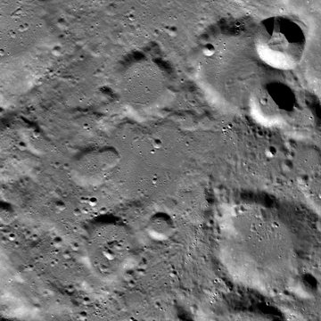
NASA on September 27 released images of the targeted landing site of Chandrayaan 2’s Vikram Lander. The images were captured by the U.S. space agency’s Lunar Reconnaissance Orbiter during a flyby on September 17, NASA said in a statement.
However, the lander could not be located as the images were taken at dusk, NASA said. “It was dusk when the landing area was imaged and thus large shadows covered much of the terrain; it is possible that the Vikram Lander is hiding in a shadow.”
The lighting will be favourable when the LRO passes over the site in October and once again attempts to locate and image the lander, NASA said. “The targeted landing site was located about 600 km from the lunar south pole in a relatively ancient terrain (70.8°S latitude, 23.5°E longitude).”
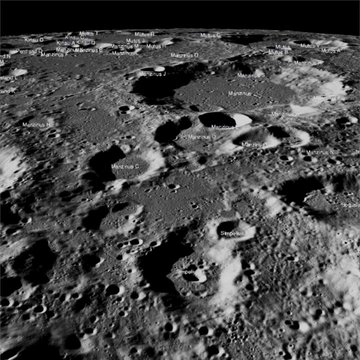
A view looking down on Chandrayaan 2 Lander Vikram’s targeted landing (image acquired before the landing attempt). Photo: NASA/Goddard/Arizona State University
“Vikram had a hard landing and the precise location of the spacecraft in the lunar highlands has yet to be determined, NASA said.
The scene was captured from a Lunar Reconnaissance Orbiter Camera Quickmap fly-around of the targeted landing site image width is about 150 km across the centre.
A wide view of a series of Lunar Reconnaissance Orbiter Camera’s narrow angle camera images collected on September 17, 2019 showing the area of Chandrayaan 2 Lander Vikram’s targeted landing site. Photo: NASA/Goddard/Arizona State University
On September 19, the senior official of the U.S. space agency confirmed that its moon orbiter has captured images of the lunar region where the Indian mission made an unsuccessful attempt to soft-land.
The probability of establishing contact with the lander ended on September 21 as the moon’s south pole entered into a lunar night on that date.
Take a a quick fly-around to visualise the targeted landing site of Vikram.


