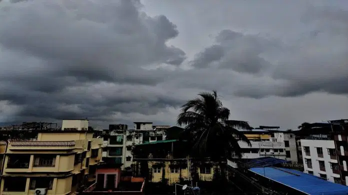
Along with this, the possibility of lightning with thunderstorms including drizzle has been expressed in more than 24 states.
Change in the weather is being seen once again across the country. According to the IMD Alert, a rain alert has been issued in more than 22 states due to the Western Disturbance and pre-monsoon activity. The weather remains pleasant due to the cloud cover. Here once again the possibility of cyclone Asani has been expressed in Odisha. All the instructions have been issued by the administration to ease the cyclonic storm. At the same time, fishermen have been prohibited from going to the shore. Along with this, the possibility of lightning with thunderstorms including drizzle has been expressed in more than 24 states.
Rain has been observed over parts of North India, especially over parts of hills and plains. Shimla also received 50 mm of rain. Light rain occurred in Manali, Qazi Gund, Ambala, Patiala, Sri Ganganagar and other areas. At the same time, IMD has issued a cyclone warning. Odisha is on high alert after the formation of a cyclonic storm over South Andaman Sea and its adjoining areas. The state government has asked all district collectors to remain alert in view of the possibility of cyclone in Odisha in the next four days.
Earlier pre-Monsoon activity is predicted to be visible over Delhi and adjoining areas today. The states include Punjab, Haryana, western Uttar Pradesh and parts of Rajasthan. These pre-monsoon activities may subside tomorrow, but isolated rain and thundershowers are very likely in some areas.
After that, on 6th May these activities will be very less and may even stop during that time. Due to this spell, most parts of North India remain cold with temperatures as high as 30 K. Heavy rains in many parts of India on Wednesday brought great relief from the scorching heat. Areas of Delhi received hailstorm in the first day, and rain was recorded at some places. On the other hand residents of Hyderabad and other areas of Telangana experienced waterlogging and inundated roads as a result of the rains.
This month’s depression over the Andaman Sea will support the progress of the monsoon and help the June-September rainfall system known to be the lifeblood of India’s economy to reach the normal time around June 1 in Kerala, India The Meteorological Department (IMD) said on Thursday.
IMD’s in-charge of cyclone monitoring, Anand Kumar Das, cited satellite imagery and called the Intertropical Convergence Zone (ITCZ) which appears as a form of clouds encircling the globe near the equator and is responsible for wet and dry weather. Is.
He said the tropics, very active. He said this indicates that monsoon surge will soon be established. “Depression will help establish cross-equatorial flow. The formation of the depression will help the monsoon to arrive in Kerala around normal time around 1st June with an error margin of +/- 5 days.
The monsoon, which typically arrives in Kerala around June 1 and covers the rest of India by mid-July, brings about 70% of India’s annual rainfall. A normal monsoon is important. Half of Indians depend on income from agriculture. About 40% of the total sown area of India does not have irrigation facilities. Half of India’s agricultural production comes from monsoon-dependent summer crops.
There was a drop in temperature in Jammu and Kashmir with widespread rain and thundershowers. According to an IMD official, the weather will remain uncertain till Thursday due to a western disturbance. Here, due to the southwesterly winds coming from the Bay of Bengal, light to moderate rain is expected in Northeast India and West Bengal-Sikkim in the next 5 days. There is a possibility of heavy rain in Assam-Meghalaya and Nagaland-Manipur Mizoram-Tripura on 5th and 10th May.
Fisherman Alert:
- Andaman Islands will receive heavy to very heavy rainfall at isolated places on May 5 and 6 and as predicted by IMD on May 6 and 7.
- May 5-6: Stormy weather with wind speed reaching 40-50 kmph and gusting to 60 kmph over South Andaman Sea and adjoining southeast Bay of Bengal.
- May 7 to 9: Wind speed reaching 45 = 55 kmph and gusting to 65 kmph over Andaman Sea and adjoining southeast and east-central Bay of Bengal.
- May 8 to 10: Wind speed reaching 55-65 kmph gusting to 75 kmph will prevail over Andaman Sea and adjoining southeast and east-central Bay of Bengal.
Apart from this, a cyclonic circulation has formed over South Andaman Sea and neighborhood on May 4. Under its influence, a low pressure area is very likely to form over the same area around May 6. It is very likely to move northwestwards and intensify gradually. There is a low pressure area during the subsequent 48 hours.
In addition, the preparedness measures to be taken in advance would be prepared from the following points. The control rooms of the District Emergency Operation Center and other offices should be operated round the clock with adequate manpower. All communication equipment like phones, faxes etc. have been directed to be kept in working condition. The satellite phone will be checked by making a test call. Satellite phones and digital mobile radio communication systems have been installed in six coastal districts under the EWDS project.
IMD’s senior scientist RK Jenamani said about the conditions in Andaman that the system is going to form in Andaman on May 4. From May 6, a low pressure system will form, which will intensify later and turn into Andaman. hurricane. He further said that the IMD has issued a warning to the people living in South Andaman and adjoining areas of Bay of Bengal.
He has also urged people not to go there as there are signs that the system may intensify further. He has requested most of the fishermen to refrain from fishing. According to the Meteorological Service, in the next 4-5 days, no heatwave conditions are expected over Northwest, Central or East India.
